Where to Find Clear Water in Panama City Beach
- PCB Prestige

- Aug 11
- 11 min read
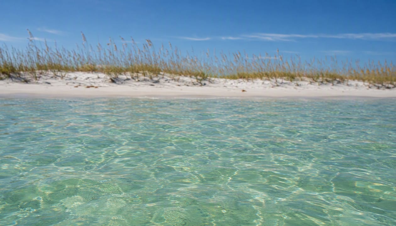
Shell Island’s Gulf-facing shore, the rock jetty at St. Andrews State Park, and the sheltered coves of St. Andrew Bay are the most reliably clear-water spots near Panama City Beach. Calm wind, an outgoing tide, and a stretch of dry weather are the three conditions that matter most. Before you leave, pull up a live beach webcam and the Florida Department of Health Healthy Beaches report to confirm both visibility and safety in under two minutes.
Key Takeaways
Shell Island’s Gulf side and St. Andrews State Park’s rock jetty are the most reliably clear spots near Panama City Beach, and a calm morning on an outgoing tide is when both look their best.
Point | Details |
Top clear-water spots | Shell Island (Gulf side), St. Andrews State Park jetty, and sheltered St. Andrew Bay coves offer the best visibility. |
Main clarity drivers | Calm wind, outgoing tide, and dry weather in the 48 hours prior are the strongest predictors of clear water. |
Fastest pre-trip check | Check a live webcam, the Florida DOH Healthy Beaches report, and a wind forecast before leaving. |
Tannins vs. pollution | Tea-stained water near outfalls is natural tannin runoff, per City of Panama City Beach guidance, not a pollution hazard. |
Pcbprestige private tours | A licensed captain reads real-time tide and wind to reach Shell Island and sheltered coves with the clearest conditions available that day. |
Table of Contents
Where you’ll find the clearest water near Panama City Beach
Panama City Beach’s signature emerald-green color comes from sunlight bouncing off the white quartz sand below the Gulf’s surface. That color is most vivid at Shell Island, St. Andrews State Park, and the areas flanking St. Andrew’s Pass. Here is where each spot fits best:
Shell Island (Gulf side): The clearest, most photogenic water in the area. No cars, no runoff, and the Gulf’s natural circulation keep visibility high. Best reached by boat or ferry. Ideal for snorkelers, underwater photographers, and families who want postcard conditions. Parking is not relevant here since there is no road access.
St. Andrews State Park and the rock jetty: Shore-accessible with a parking fee. The jetty creates a natural channel where tidal flow keeps the water moving and relatively clear. Snorkelers see fish, sea grass, and the occasional stingray when surf is low. Crowds build on summer weekends, so a weekday morning is worth the early alarm.
St. Andrew’s Pass (east and west sides): The tidal current through the pass flushes sediment and keeps water clear between tidal cycles. The east side (near the park) is calmer for beginners; the west side has stronger current. Both reward snorkelers and photographers when the tide is right.
Sheltered coves in St. Andrew Bay: Calmer than the Gulf side, with less wave action. Good for families with young children or anyone who wants flat, clear water without open-ocean exposure. Visibility is slightly lower than the Gulf side but still excellent on calm days.
Pro Tip: Ferry services to Shell Island run from St. Andrews State Park. The first boats leave early in the morning, and those early passengers consistently get the calmest, clearest water before afternoon wind picks up. Book the first available crossing if conditions look good.
For a full breakdown of top snorkeling locations near PCB, Pcbprestige’s local guide covers specific spots and practical gear advice.
What actually changes water clarity in PCB
Water clarity at Panama City Beach is not random. A handful of physical drivers control what you see on any given day, and knowing them lets you predict conditions before you arrive.
Wind and wave energy: This is the biggest short-term driver. Onshore winds above roughly 10–15 mph stir up bottom sediment and create surface chop that scatters light. A calm or offshore wind leaves the water glassy and clear.
Tide direction and current through the passes: An outgoing tide pulls cleaner Gulf water through St. Andrew’s Pass and flushes turbid bay water out. Incoming tides can push bay water toward the Gulf side, temporarily reducing clarity near the passes.
Recent rainfall and runoff: Heavy rain washes tannins, sediment, and nutrients off land and into the bay. Clarity typically drops for 24–48 hours after a significant storm and recovers as the runoff disperses.
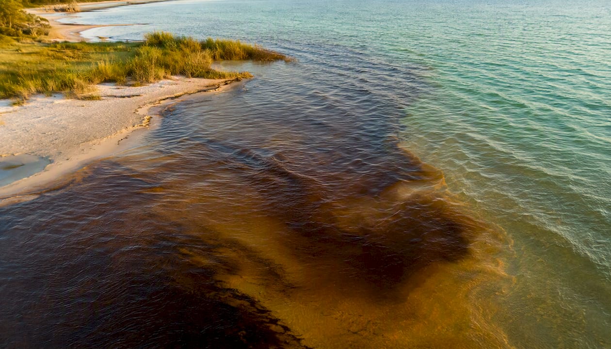
Tannin outfalls: You may see dark brown, tea-stained streaks near shoreline pipes or outfalls. The City of Panama City Beach explains that this coloration comes from natural tannins in spring-fed lakes draining to the Gulf and is typically not a pollution hazard. It looks alarming but usually clears within a short distance from the outfall.
Surf and swell: Larger swell churns sand off the bottom and reduces underwater visibility even when the surface looks clear from shore. Shell Island sea-condition forecasts show how quickly swell height and risk tags change day to day.
Wind and tide together account for the majority of short-term clarity changes at PCB. A calm morning after a dry, windless night is the single strongest predictor of clear water, regardless of season.
How to check current water clarity and safety before you go
This checklist takes about five minutes and gives you a reliable read on conditions before you commit to the drive.
Check a live beach webcam. Look for surface chop, color, and any visible outflow discoloration. Panama City Beach pier cams and harbor cams give the fastest visual read. Note the camera angle and time of day — direct morning sun can wash out color and make water look clearer or darker than it is.
Check the Florida DOH Healthy Beaches report. The Florida Department of Health Healthy Beaches program posts regular bacteria sampling results for PCB-area beaches. Look for the most recent sample date and result before swimming.
Check a third-party aggregator for county results. SafeToSwimFlorida’s Shell Island page surfaces Bay County sampling data in a readable format, including recent test results and dates. Cross-reference the date against the official DOH portal to confirm you are reading current data.
Check tide and sea-condition forecasts. Shell Island sea conditions on Tide-Forecast show swell height, wind speed, and risk tags. Plan for an outgoing tide window when possible.
Check local wind forecasts. Windfinder’s Shell Island forecast shows wind direction and speed by the hour. Winds under 10 mph from the north or northwest are the sweet spot for calm Gulf water.
Call a local captain or tour operator if you are unsure. Operators on the water daily have the most current read on conditions, tannin outflows, and which spots are running clear. A two-minute call can save a wasted trip.
Pro Tip: Webcams show surface appearance, not underwater visibility. Pair the visual check with the Windfinder wind forecast: if wind is under 10 mph and has been calm overnight, the water is almost certainly clear below the surface too, even if the cam angle makes it hard to judge.
Best time of day and season to find the clearest water
Timing matters as much as location when you are chasing clear water at Panama City Beach.
Best time of day: Early morning, ideally before 10 AM. Overnight calm lets sediment settle, and there is no afternoon sea breeze yet to stir things up. Light angles are also better for seeing into the water rather than off the surface.
Best tide window: Outgoing or low tide near the passes and jetties. The tidal flush through St. Andrew’s Pass is most pronounced on a falling tide, and that is when clarity near the jetty and Shell Island’s bay side peaks.
Best seasons: Late summer through fall (September through November) tends to offer calmer seas, less storm activity, and lower runoff compared to the peak of hurricane season. Travel guides covering PCB water clarity point to fall shoulder months as consistently good for visibility. Spring (March through May) can also be excellent before summer thunderstorm patterns develop.
Summer pattern: June through August brings the most visitors and the most afternoon thunderstorms. Morning windows are still excellent, but afternoon conditions can deteriorate quickly after a storm cell passes through.
Weather fronts: A cold front passage typically brings strong winds for 24–48 hours, churning the water. Two or three days after the front clears, with calm high-pressure conditions, clarity often reaches its best of the season.
For timing advice that also covers dolphin activity windows, the best times to spot dolphins in Panama City Beach guide covers the same tidal and weather factors.
Is the water safe? Bacteria, red tide, and how to verify
Clear water does not automatically mean safe water. These are the hazards worth checking before you get in.
Bacterial contamination: Most common in the 48 hours after heavy rainfall, when stormwater runoff carries bacteria into the Gulf. The Florida DOH Healthy Beaches program is the authoritative source. Check the sampling date carefully — a “good” result from two weeks ago tells you nothing about today.
Harmful algal blooms (red tide): Red tide events can occur along the Florida Panhandle, though they are less frequent here than on the southwest coast. Symptoms include respiratory irritation near the water and fish kills on the beach. The Florida Fish and Wildlife Conservation Commission posts current bloom locations and concentrations.
Jellyfish: Seasonal and wind-driven. Onshore winds push jellyfish toward the beach. Check webcams for visible blooms and ask locals or lifeguards on arrival.
Rip currents: Invisible from the surface and unrelated to water clarity. Clear water can still have dangerous rip currents, especially near passes and jetties. Check the rip current safety guide for Panama City Beach before entering the water near any pass or jetty.
For the most current bacteria results, the Florida DOH Healthy Beaches portal is the primary official check. SafeToSwimFlorida aggregates Bay County results in a more readable format, but always confirm the sampling date on the DOH portal for official status.
Avoid entering the water for at least 24–48 hours after heavy rainfall or when you see visibly discolored outflows near storm drains or pipes. The tea-stained tannin streaks the city describes as natural are different from the gray-brown murk that follows a storm — the latter carries a real bacterial risk.
Best ways to experience the clearest water: shore, jetty, or a private boat tour
How you get to the water shapes what you actually see. Each access method has a different clarity ceiling.
Shore access (main public beaches): Convenient and free, but clarity varies with wind and foot traffic. On calm days the water is genuinely beautiful. On busy summer afternoons, wave action and crowds stir up sand. Good for a casual swim; less reliable for snorkeling or photography.
Rock jetty at St. Andrews State Park: One of the best shore-accessible snorkeling spots in the area. The jetty’s structure creates habitat and the tidal current keeps visibility reasonable. Trip accounts from St. Andrews describe seeing clear water and fish near the rocks when surf is low. Entry fee applies; parking fills early on weekends.
Shell Island by boat or ferry: The clearest, most consistent option. No road access means no runoff, no foot traffic stirring the shallows, and the Gulf’s natural circulation does its job undisturbed. Snorkelers and photographers consistently rate this as the best visibility in the area.
Sheltered St. Andrew Bay coves: Flat, calm water with good visibility on most days. Excellent for family activities in Panama City Beach involving young children or anyone who prefers protected water. Less dramatic than the Gulf side but more predictable.
Private captain-guided boat tour: The highest-reliability option for clear water. A licensed captain reads conditions in real time and can pivot to a sheltered cove, a different side of Shell Island, or a calmer pass depending on what the tide and wind are doing that morning. You are not locked into a fixed route the way a ferry is. Pcbprestige’s 26-foot powerboat reaches Shell Island and the bay’s clearest pockets quickly, with snorkel gear included and a bathroom on board.
Pro Tip: Bring polarized sunglasses. They cut surface glare and let you see into the water column from the boat or the shore — you will spot fish, rays, and sand dollars you would otherwise miss completely. A small bottle of snorkel mask defogger is worth the space in your bag.
For a broader look at Florida Panhandle tour options and how boat access changes what you can reach, that regional guide covers the range of coastal tour formats well.
Quick pre-trip checklist for seeing clear water
Run through this before you leave the house:
Check a live PCB beach webcam for surface color and chop
Pull up the Florida DOH Healthy Beaches report and confirm the most recent sample date
Check Windfinder or a similar wind forecast — aim for under 10 mph
Review the tide chart and plan to arrive near outgoing or low tide
Verify no red tide or harmful algal bloom alerts for Bay County
Pack polarized sunglasses, a snorkel mask with defogger, and a rash guard
Plan to launch by 9 AM for the calmest, clearest conditions
Why private tours often find clearer water than you will on your own
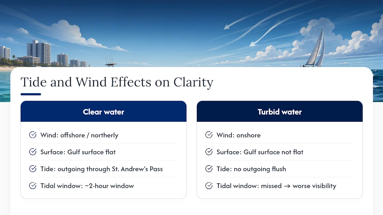
Reading conditions is a skill that takes time on the water to develop. A local captain checks wind direction before sunrise, not just wind speed. An offshore or northerly wind keeps the Gulf surface flat even when the forecast shows a moderate reading. An onshore wind of the same speed does the opposite.
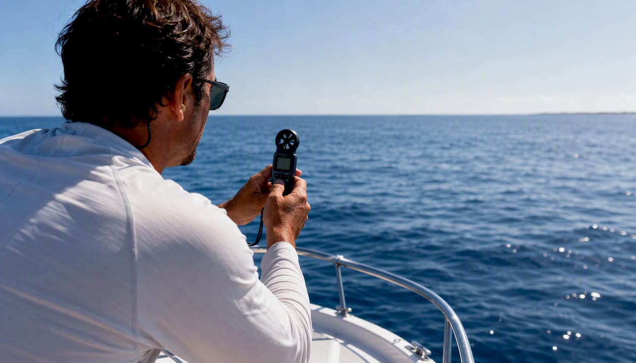
The tidal window matters just as much. An outgoing tide through St. Andrew’s Pass creates a natural flush that clears turbid water from the bay side and pulls cleaner Gulf water toward Shell Island. That window is roughly two hours wide, and it shifts by about 50 minutes each day. Missing it by an hour means noticeably different visibility.
Tannin outflows are the other variable most visitors misread. A brown streak near a shoreline pipe looks like pollution but is usually harmless freshwater draining from inland lakes. A captain who knows the local outfall locations steers around them automatically, keeping the boat in clear water without the guests ever realizing there was a choice to make.
The practical result: a private tour that departs at the right tide, reads the wind correctly, and knows which coves are sheltered from the current swell will almost always find clearer water than a visitor navigating the same area independently for the first time.
A private tour built around clear water and Shell Island
Pcbprestige runs fully private dolphin watching, Shell Island snorkeling, and sunset cruises on a 26-foot powerboat with a licensed local captain. Every charter is yours alone — no strangers, no fixed group schedule, and no route you cannot adjust. The captain reads tide and wind conditions on the morning of your trip and picks the clearest, calmest spots available that day.
All snorkel equipment is included, the boat has a bathroom on board, and the itinerary flexes around what the water is doing. If Shell Island’s Gulf side is running clear, you go there. If a sheltered bay cove is the better call that morning, the captain takes you there instead. That kind of real-time decision-making is what consistently puts guests in the clearest water PCB has to offer. Book your private tour or browse available tour options to find the right fit for your group.
Sources
Use these before every trip. Each one tells you something different, and together they give a complete picture.
Recommended
Comments